Out of TownSection 5
B. Everett Jordan Lake and the Towns That Weren't There Yet
Jordan Lake sits in Chatham County, roughly fifteen miles southwest of Chapel Hill, behind a dam on the New Hope Creek arm of the Haw River watershed.
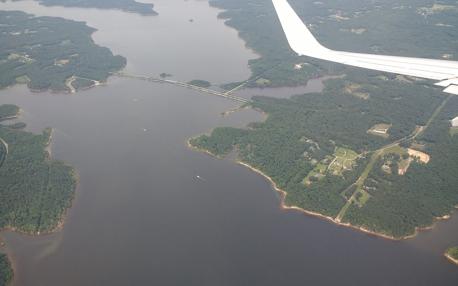
The reservoir arrived before the region did
The U.S. Army Corps of Engineers completed the dam in 1981 after more than a decade of construction, impounding roughly 14,000 acres of water surface at normal pool. The project was authorized under the Flood Control Act of 1963 and named for B. Everett Jordan, the North Carolina senator who shepherded its federal authorization.
The engineering rationale was straightforward: control flooding on the Cape Fear River basin, provide municipal water supply, and maintain downstream flow in dry years. What the planners could not fully anticipate was how thoroughly the Triangle would grow toward the reservoir rather than away from it. The communities that now depend on Jordan Lake for drinking water — Cary, Apex, Holly Springs, and others in western Wake County — were either small towns or barely-incorporated places when construction began. Cary had fewer than 8,000 residents in 1970; it would surpass 170,000 by the 2020 census, making it one of the fastest-growing municipalities in the American South. The infrastructure preceded the demand by a generation and then found itself strained by exactly the growth it had quietly enabled.

The lake is managed today under what state regulators call the Jordan Lake Rules, a set of nutrient management standards adopted by the North Carolina Environmental Management Commission to address nitrogen and phosphorus loading from upstream development. Runoff from subdivisions, roads, and lawns across the watershed feeds algae blooms that have periodically compromised water quality and closed swimming areas. The rules have been a persistent source of conflict between downstream water utilities, agricultural interests, and environmental advocates since their adoption.
Boating, fishing, and swimming draw significant use from across the Triangle on weekends, and the state recreation area surrounding the lake includes more than 13,000 acres of Piedmont forest and shoreline managed by North Carolina State Parks. The experience at the water's edge — wide coves, osprey, and shoreline that has not yet been paved — sits in sharp contrast to the suburban density pressing in from the northeast.
The dam itself is a federal structure on the Haw River arm near the town of Moncure. Stand at its downstream face and the Haw River resumes below, flowing on toward its confluence with the Deep River, where the Cape Fear begins. The region that diverted it and drank from it is barely forty years old. The river has been there considerably longer.